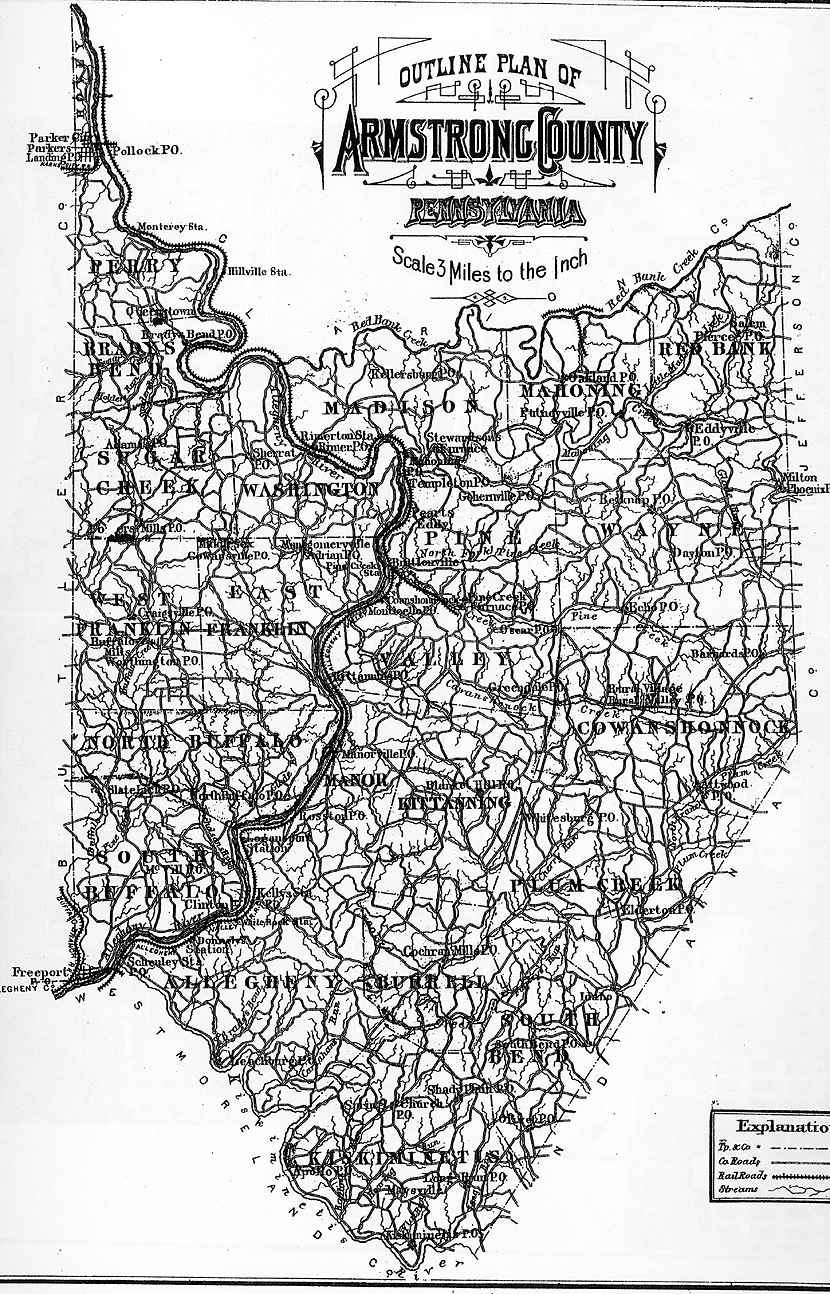
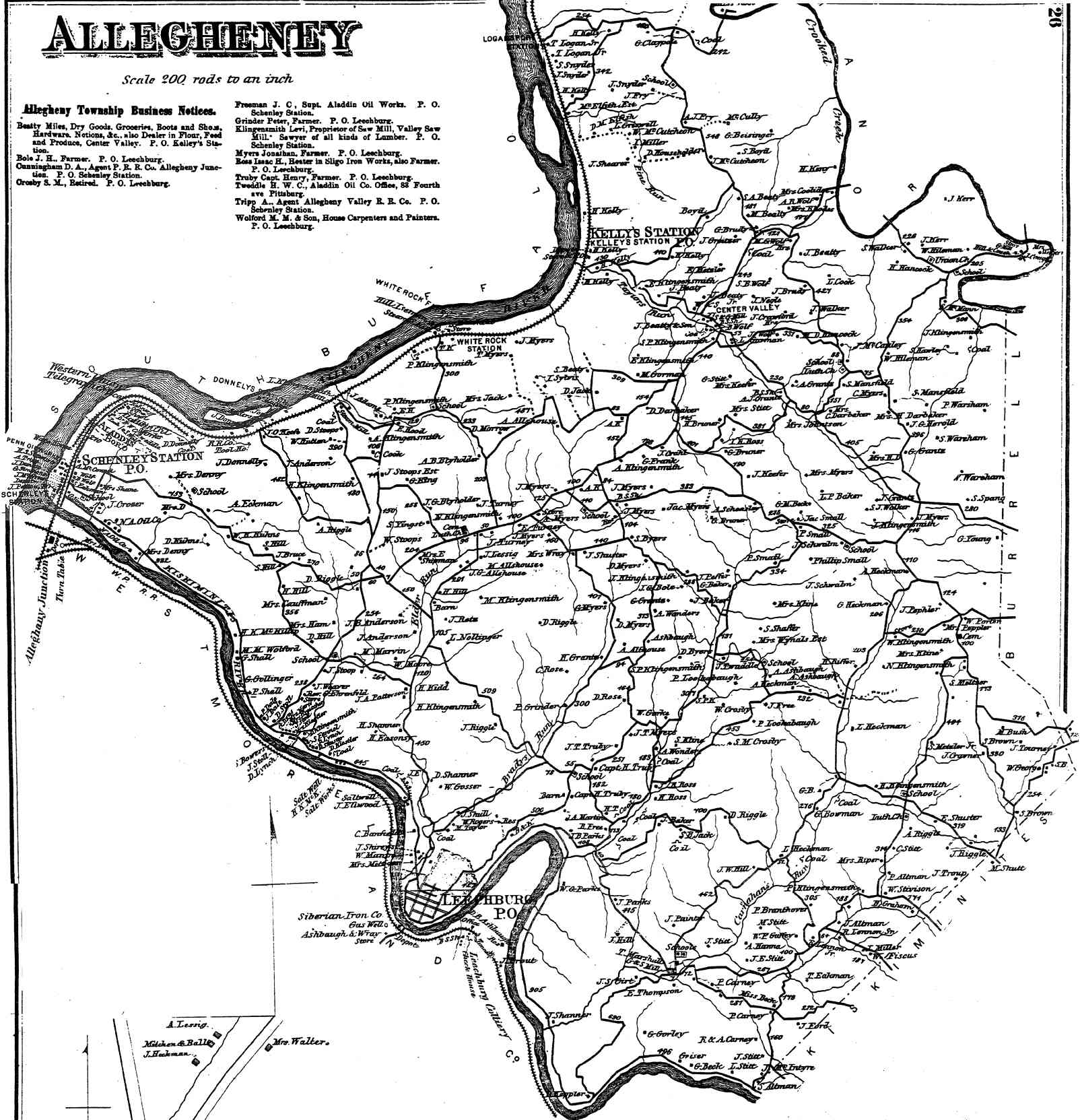
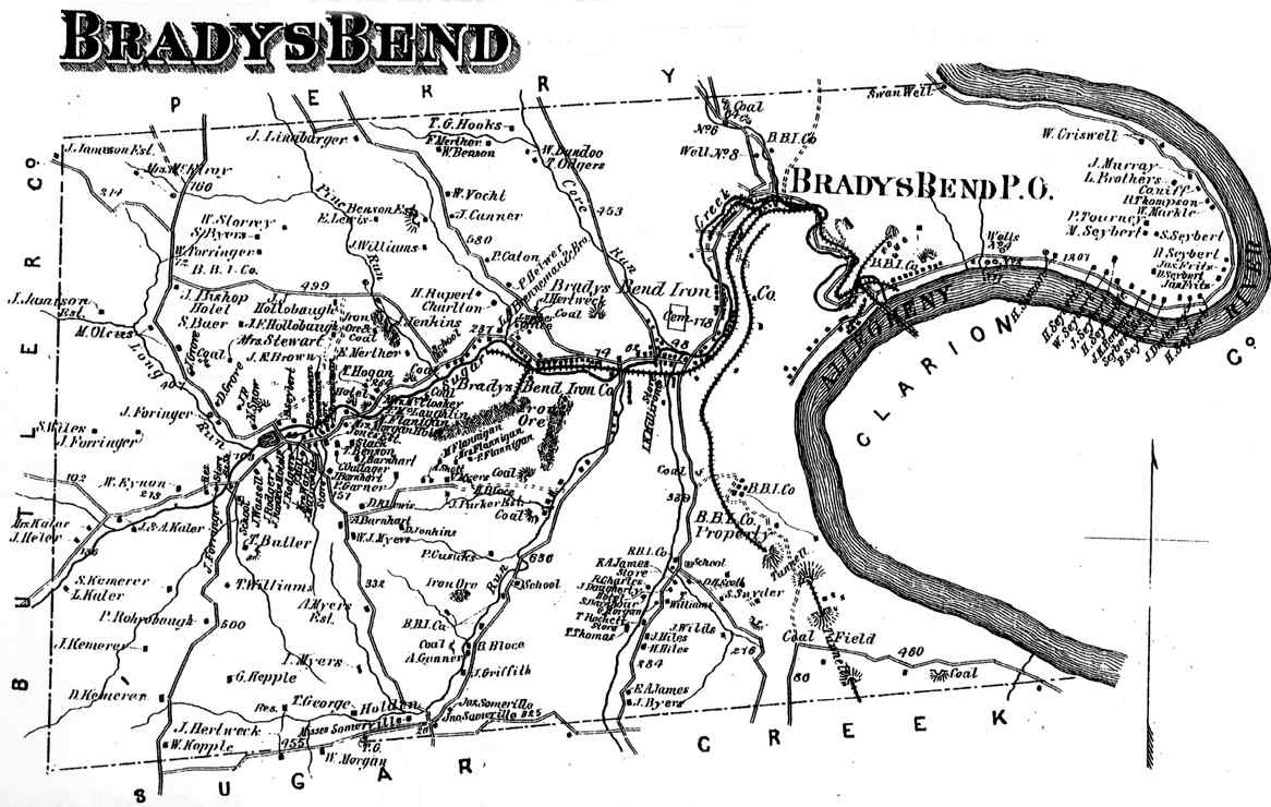
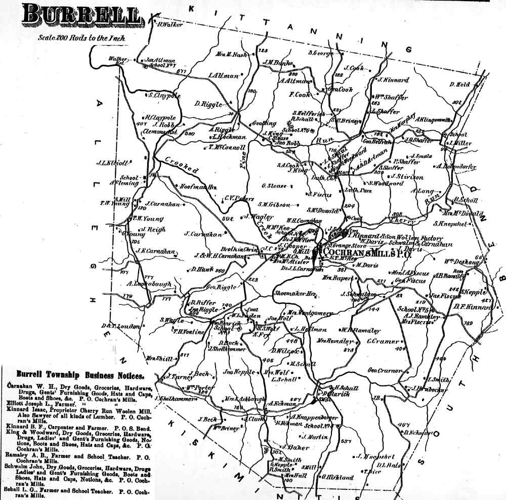
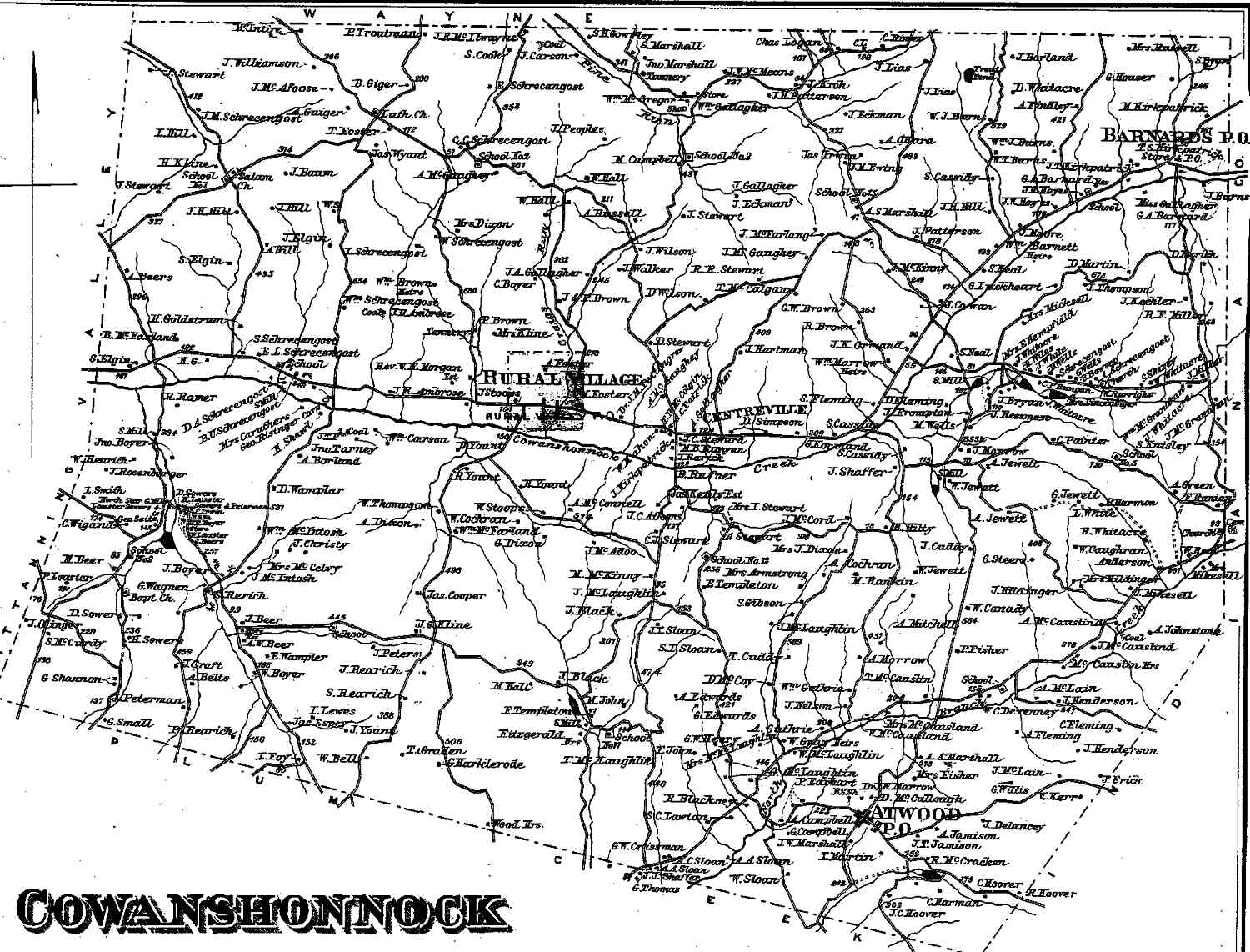
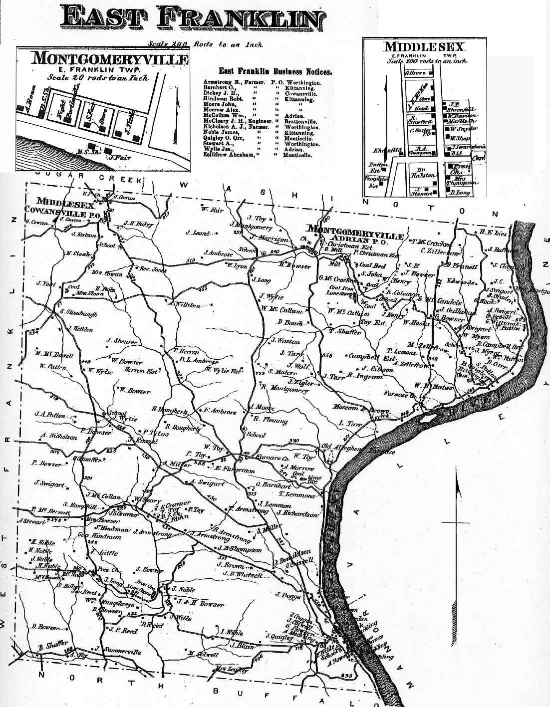
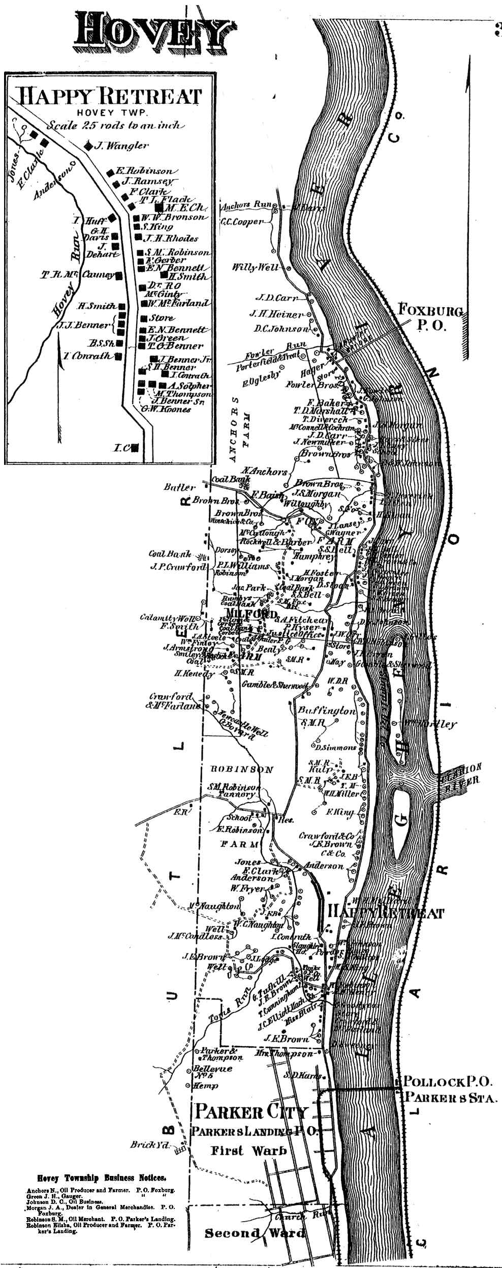
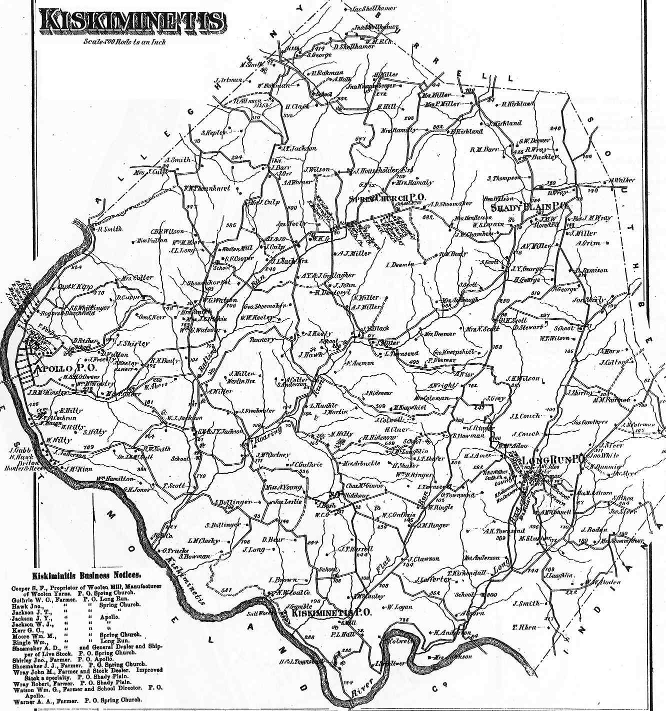
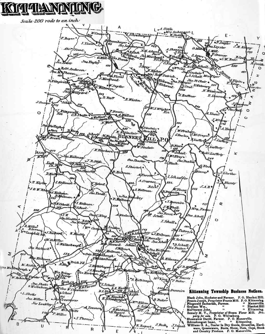
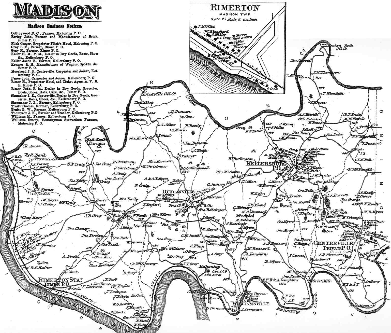
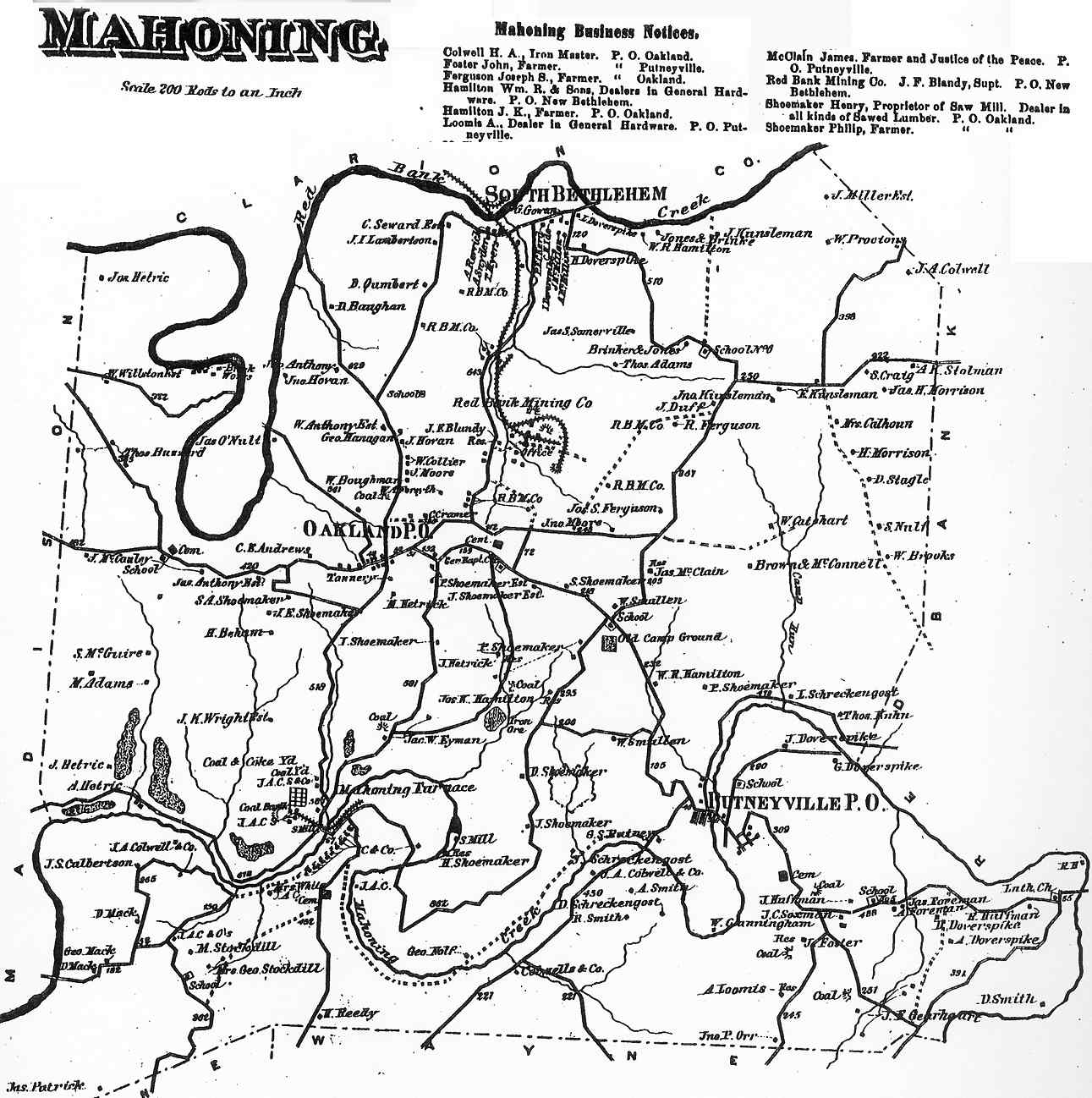
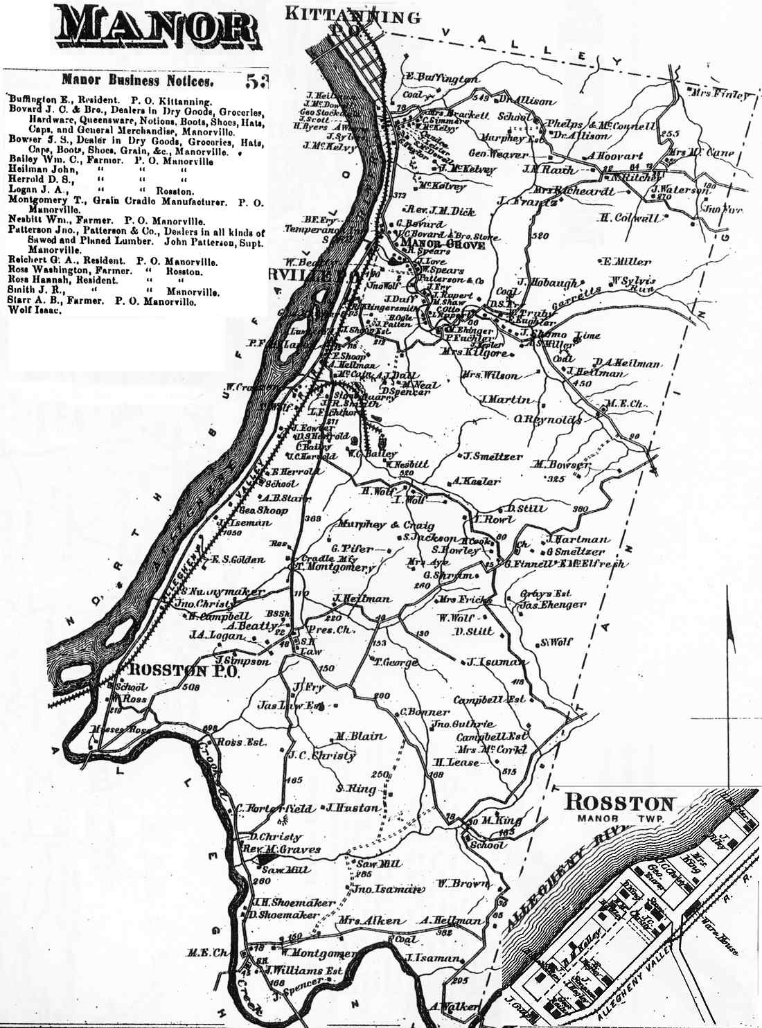
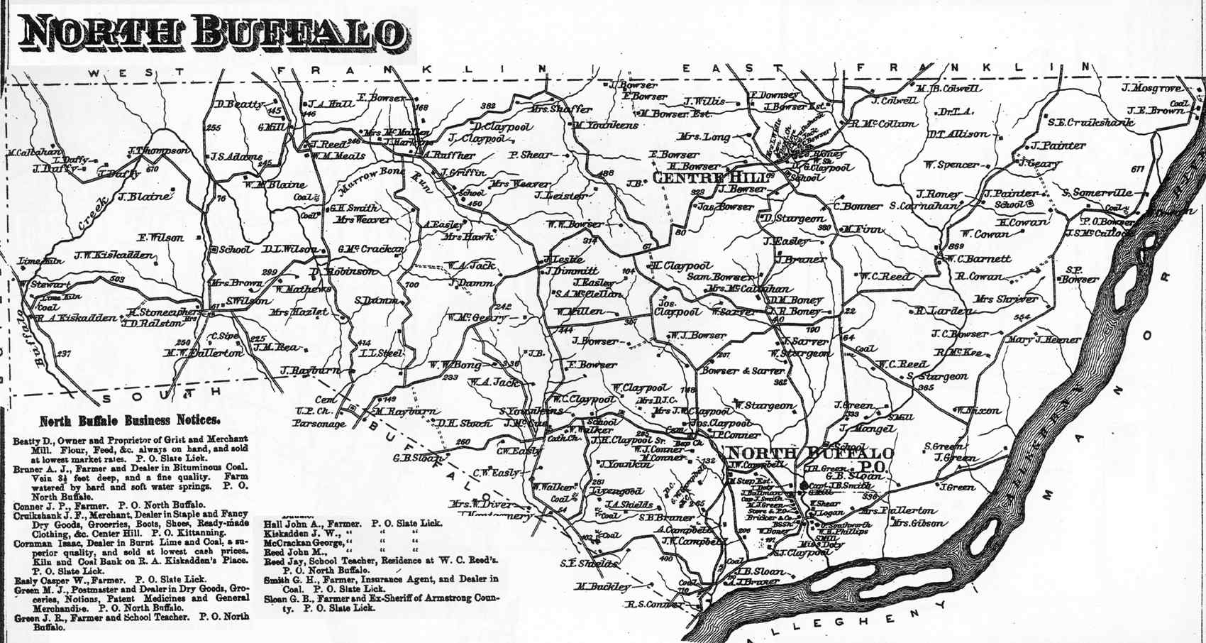
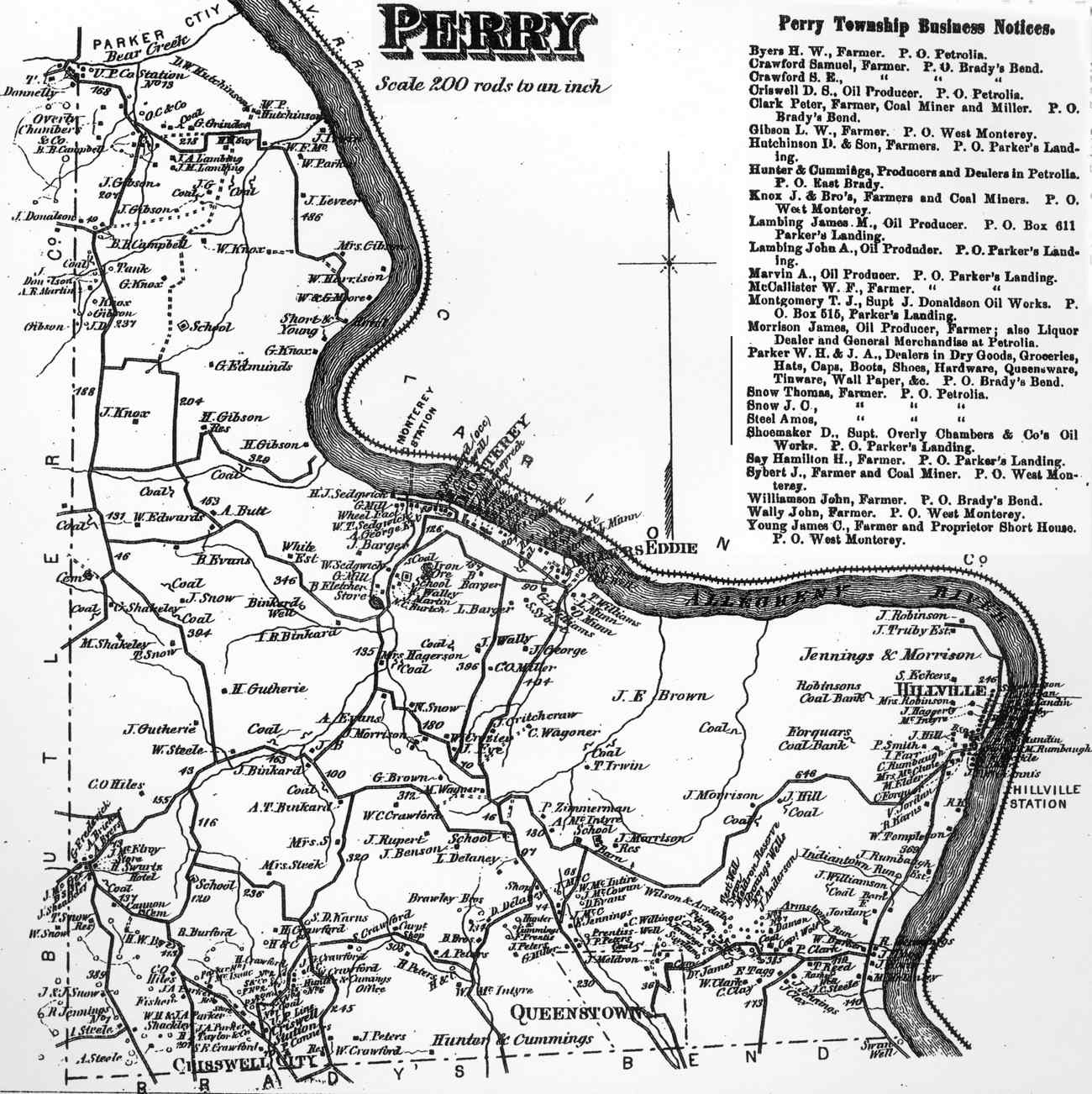
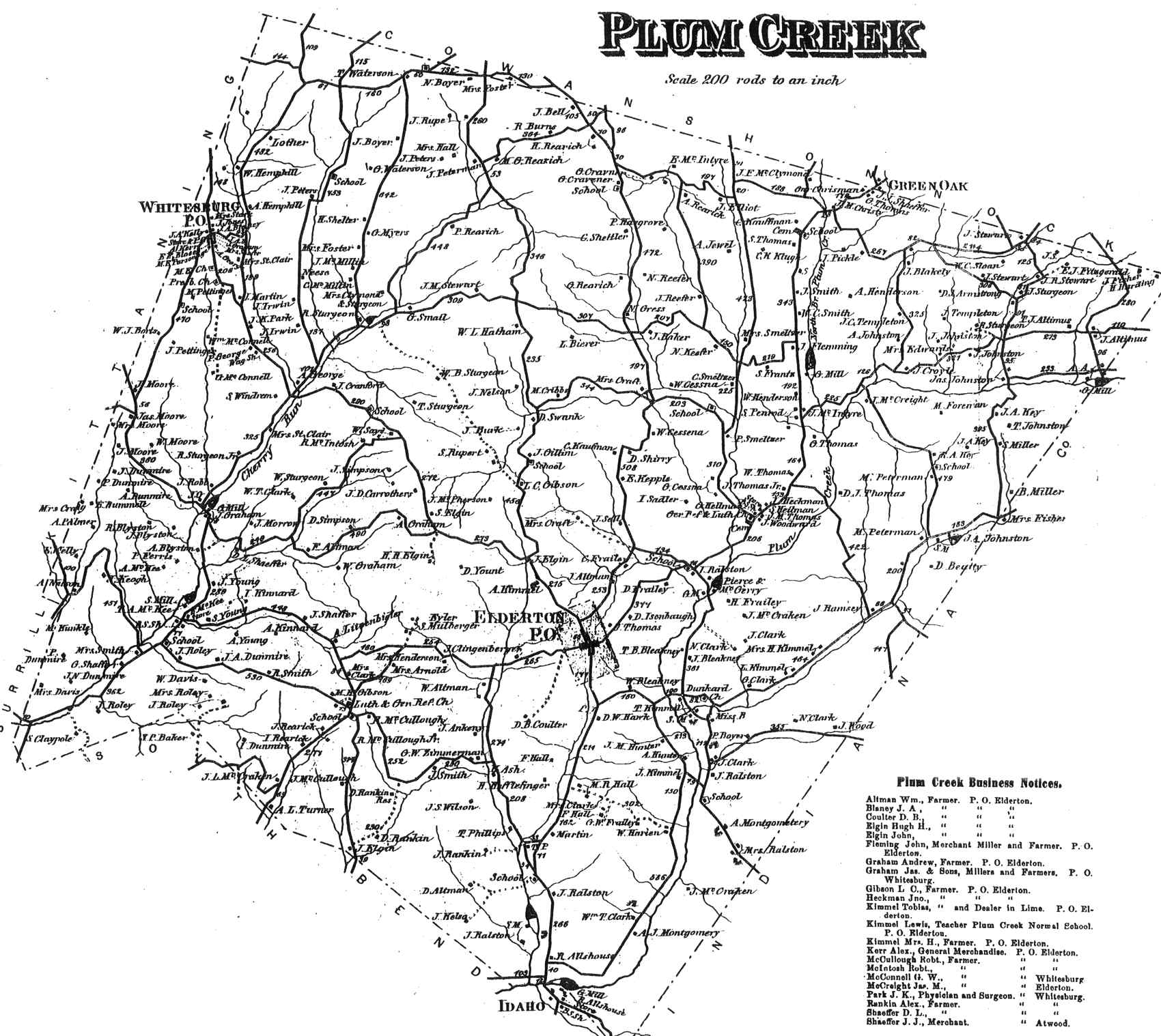
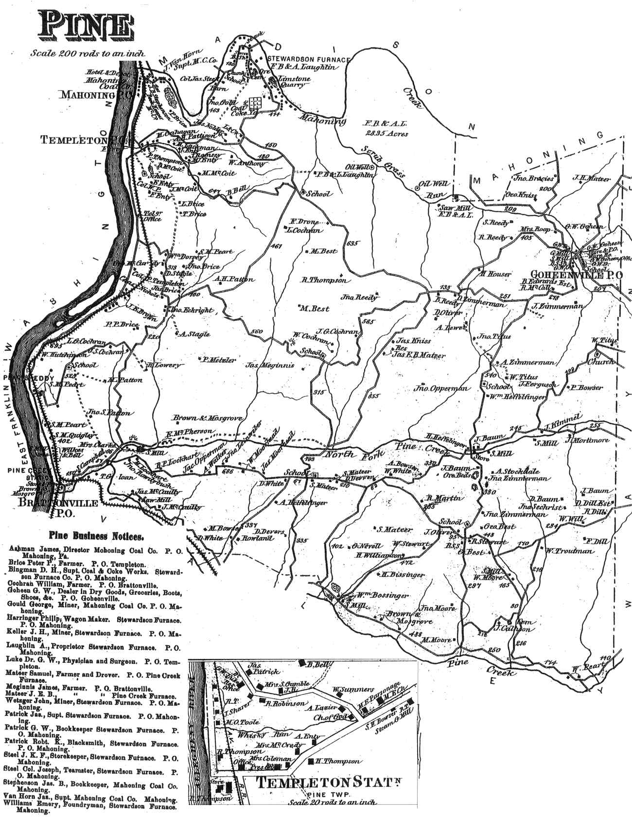
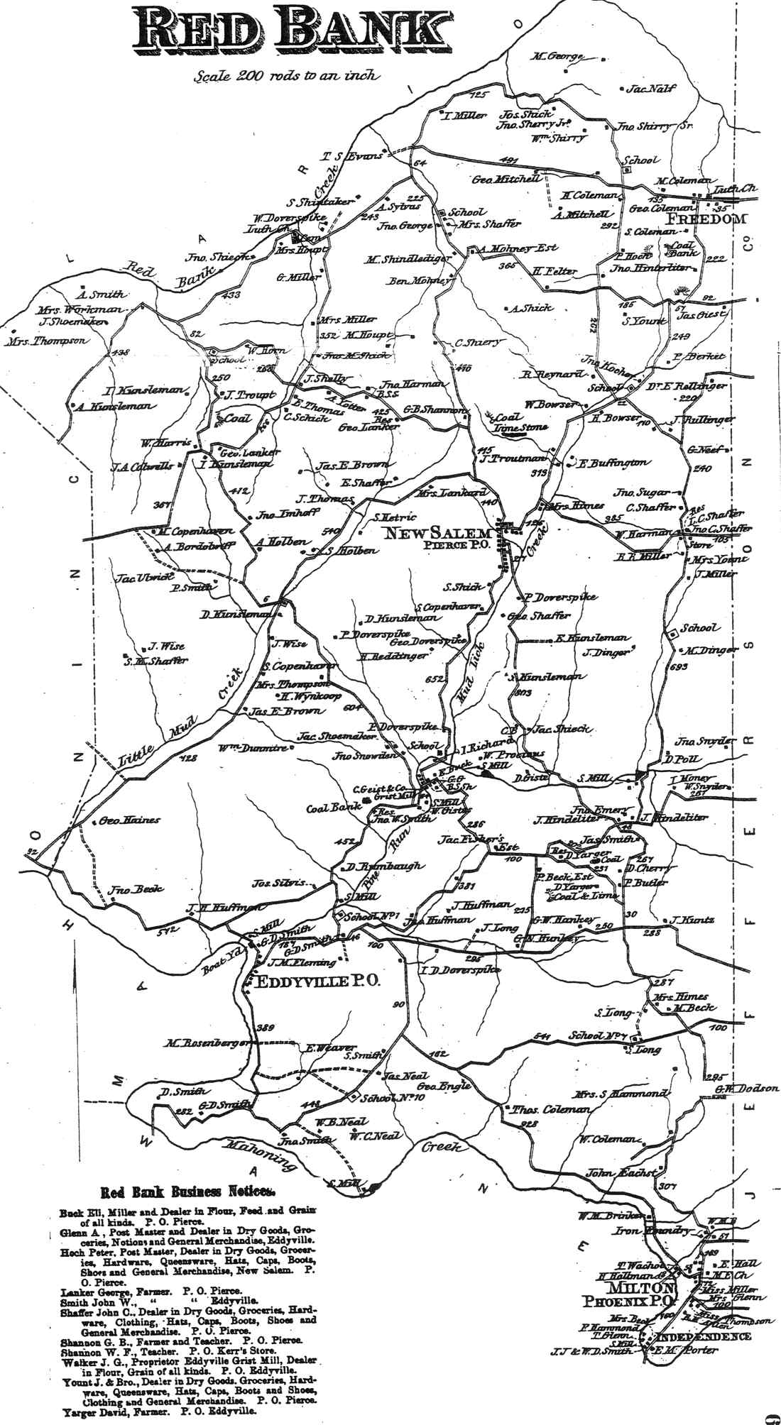
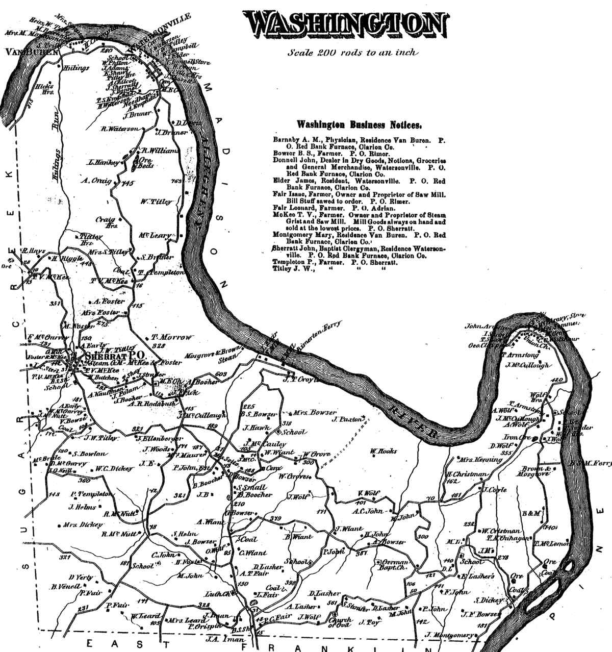
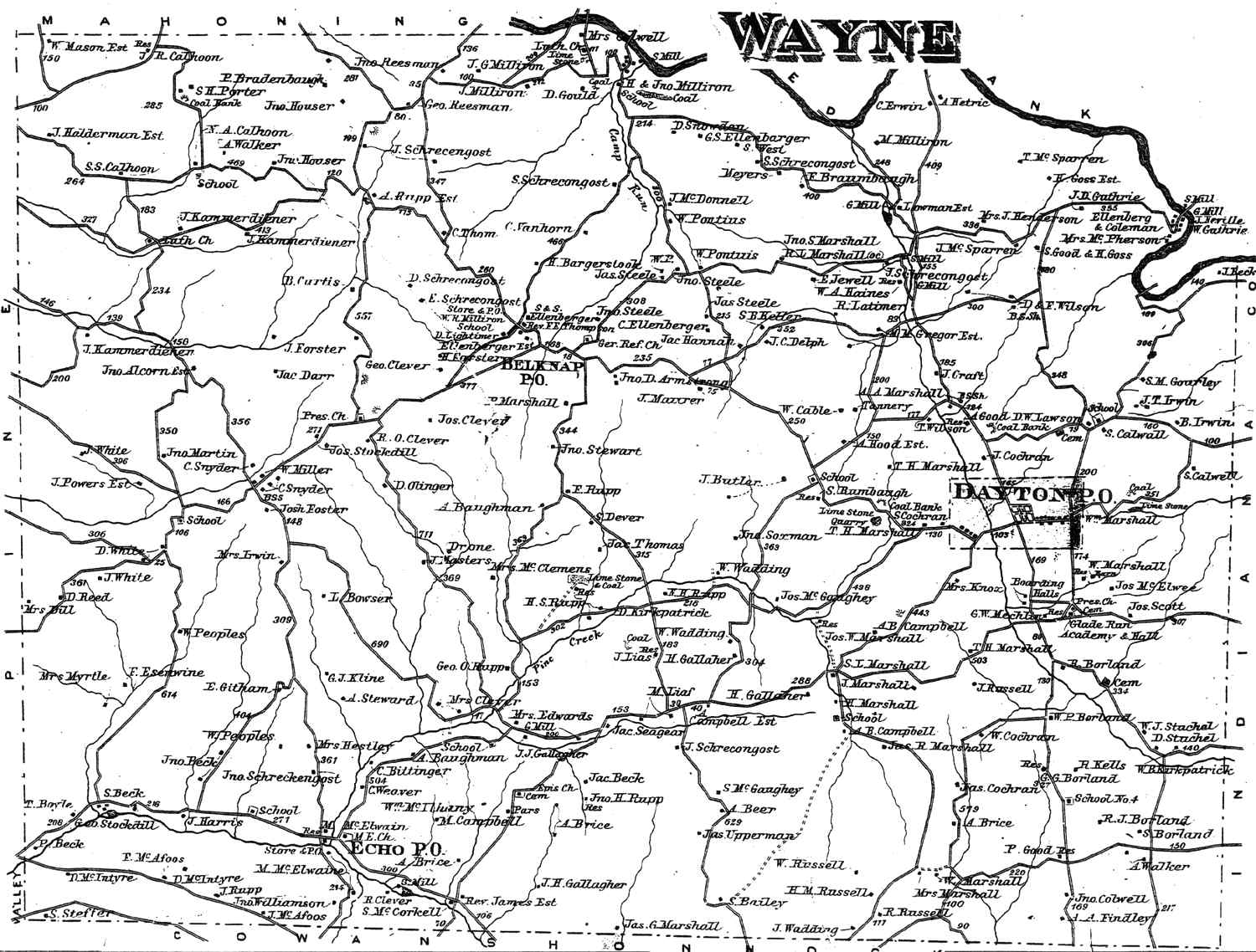
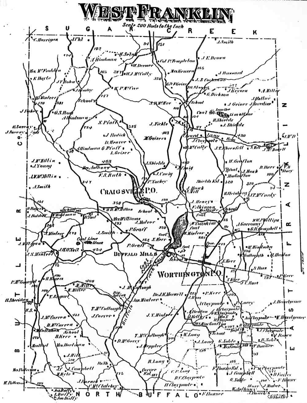
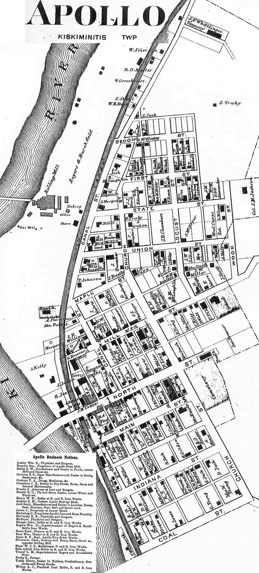
Township and borough maps of Armstrong County Pennsylvania from the Atlas of Armstrong County Pennsylvania. From actual surveys by Beach Nichols; published by Pomeroy, Whitman & Co., Philadelphia, 1876.
|
TOWNSHIP MAPS Atlas page numbers are shown in parentheses. |
||
|---|---|---|
|
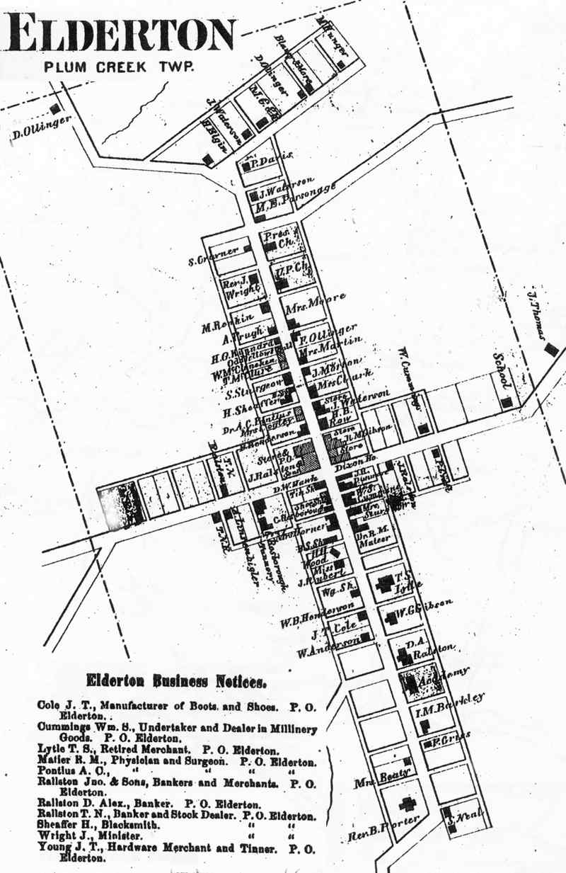
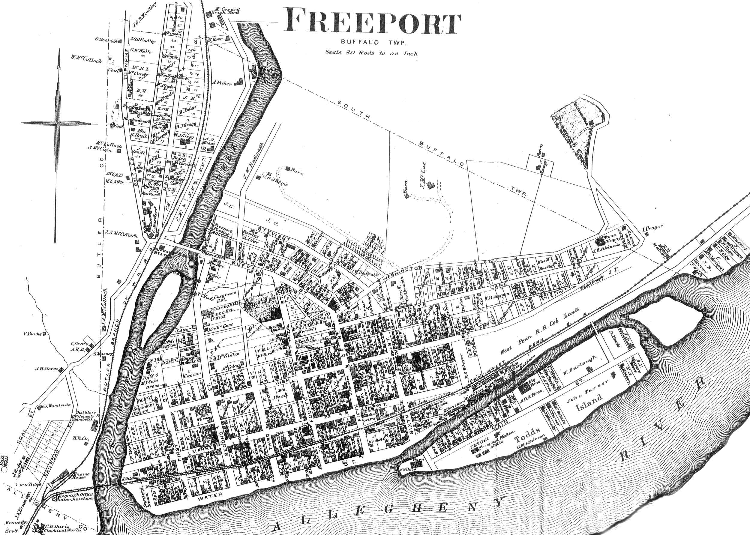
Alleghany (26) Brady's Bend (29) Burrell (31) Cowanshonnock (33) East Franklin (35) Hovey (37) Kiskiminetis (43) Kittanning (47) |
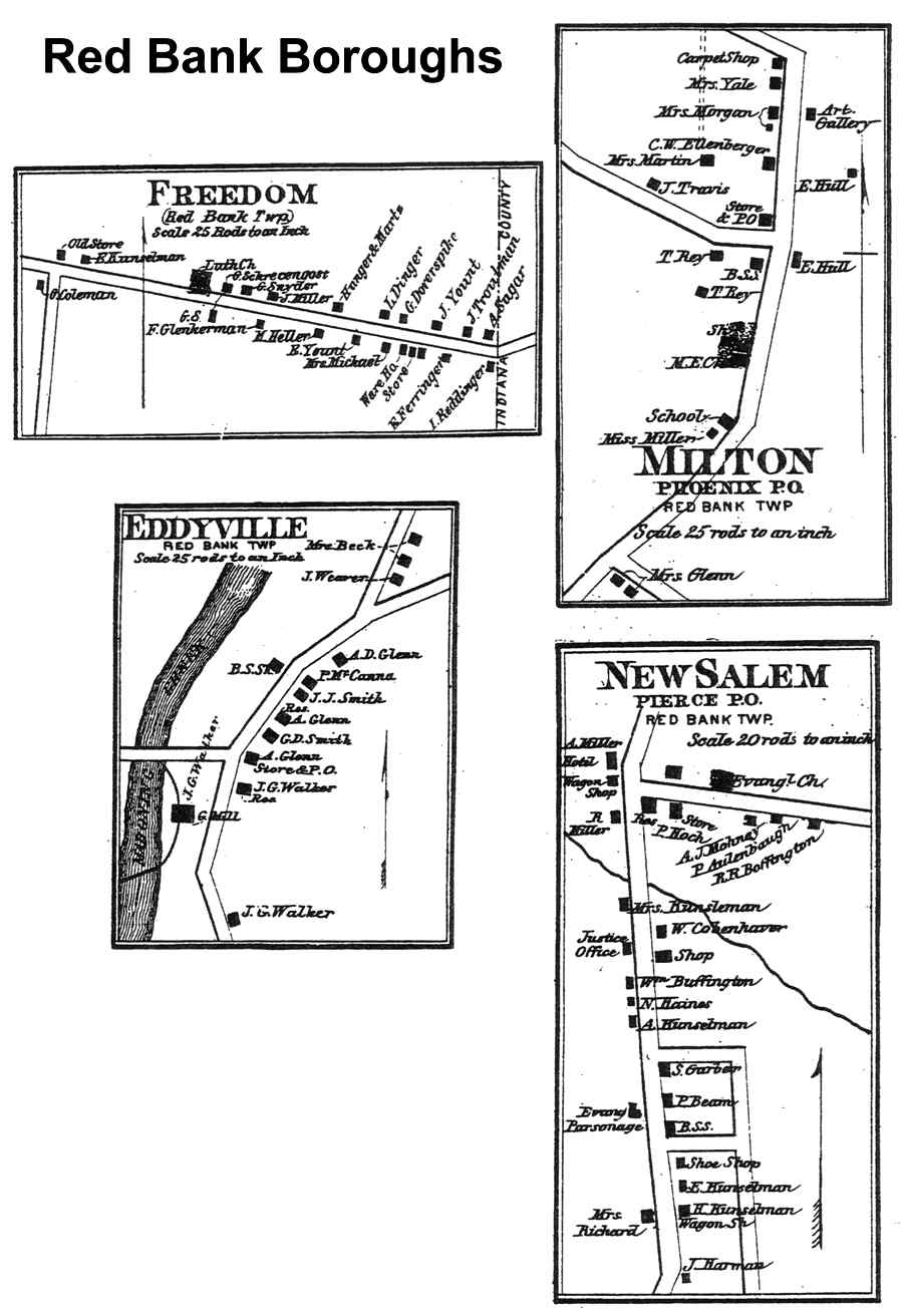
Madison (49) Mahoning (52) Manor (53) North Buffalo (55) Perry (57) Plum Creek (60) Pine (63) Red Bank (66) |
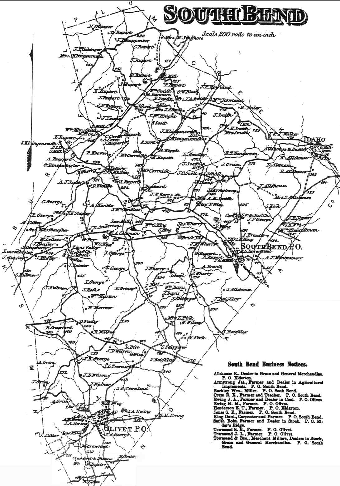
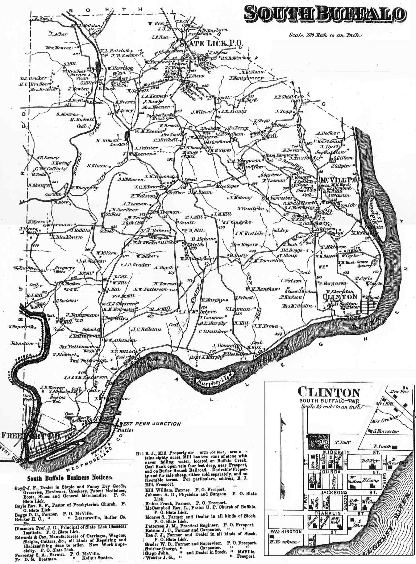
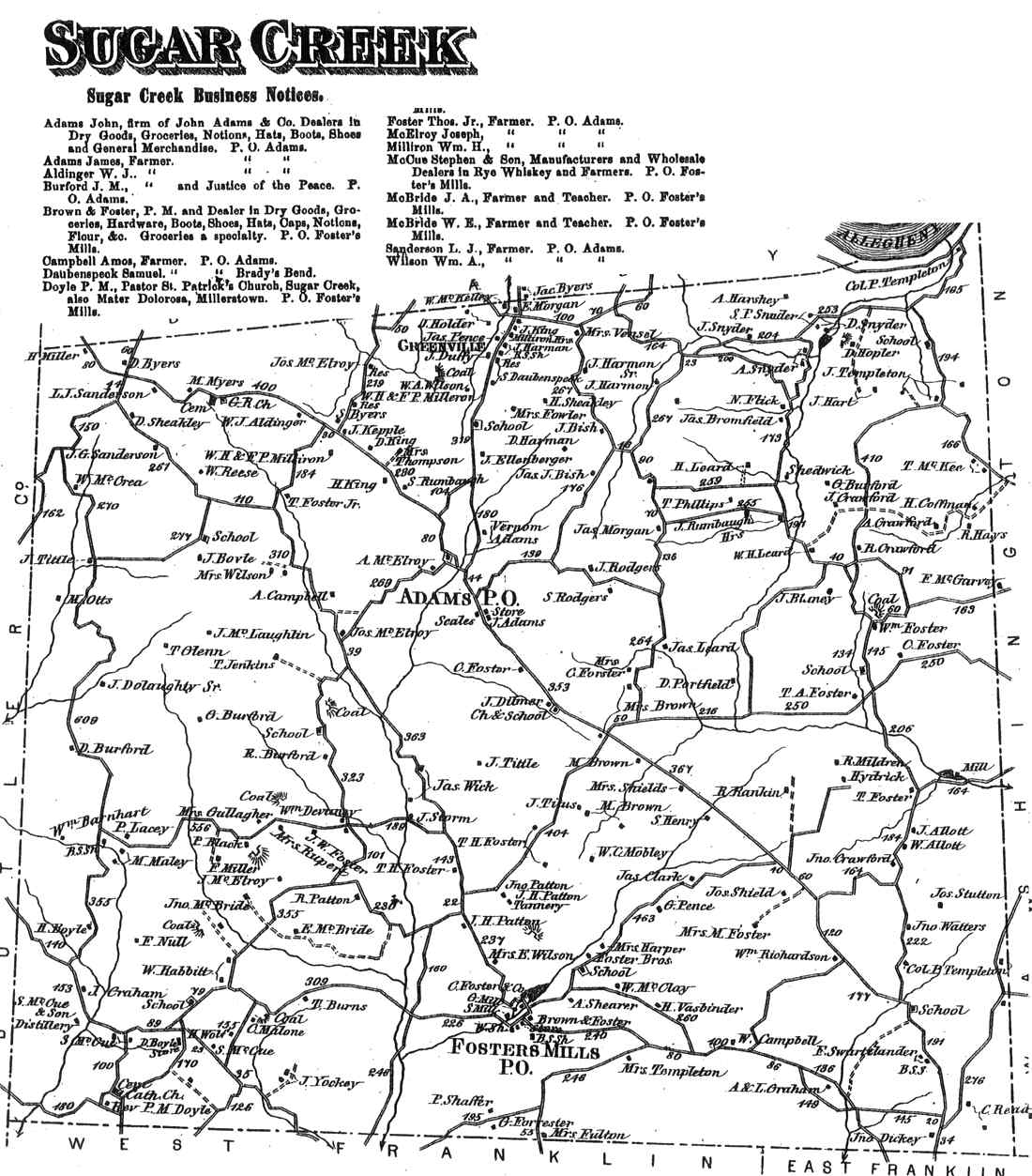
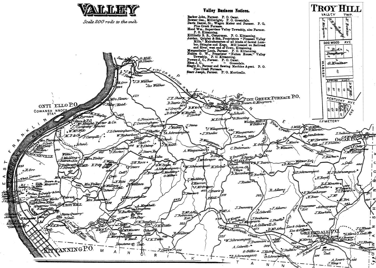
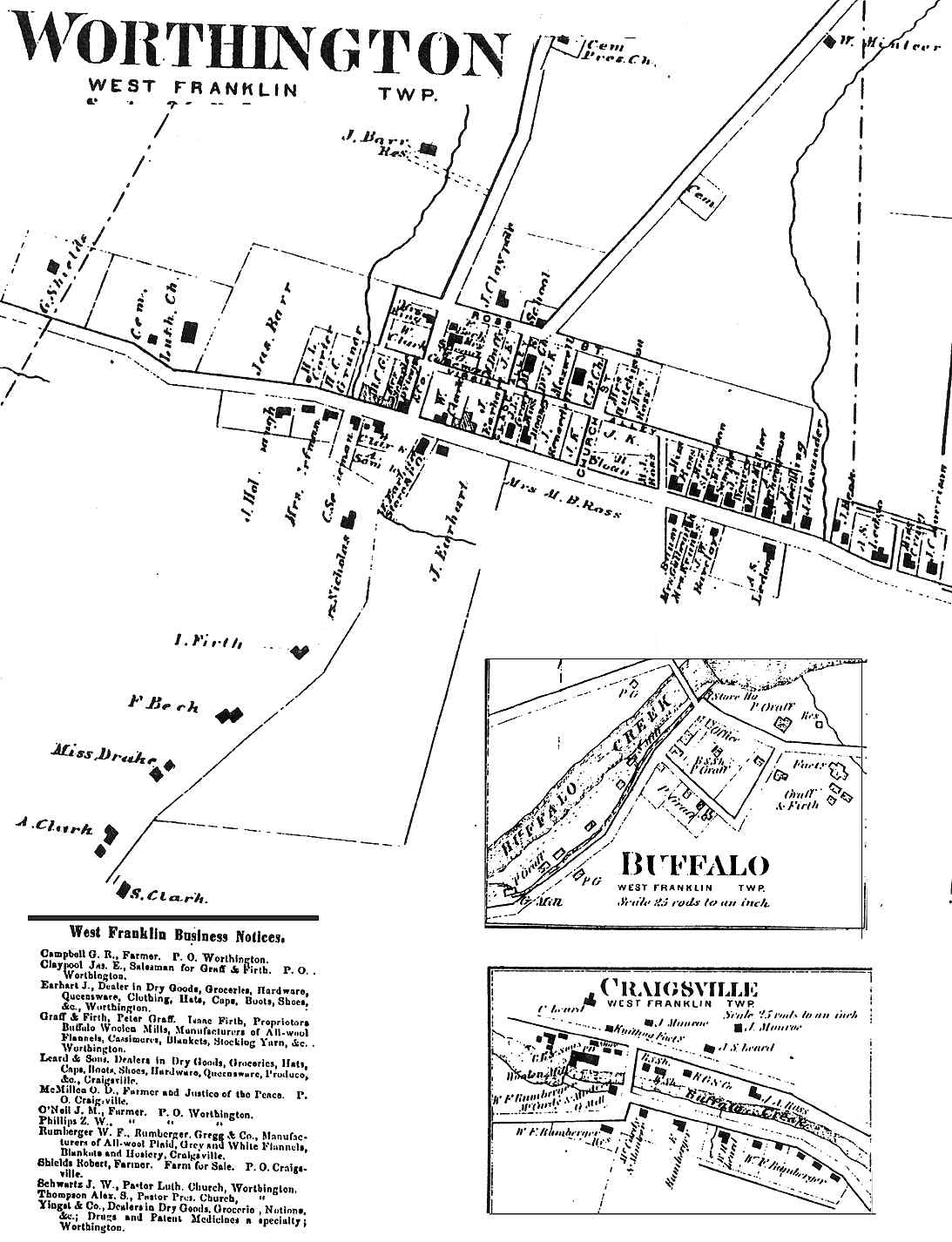
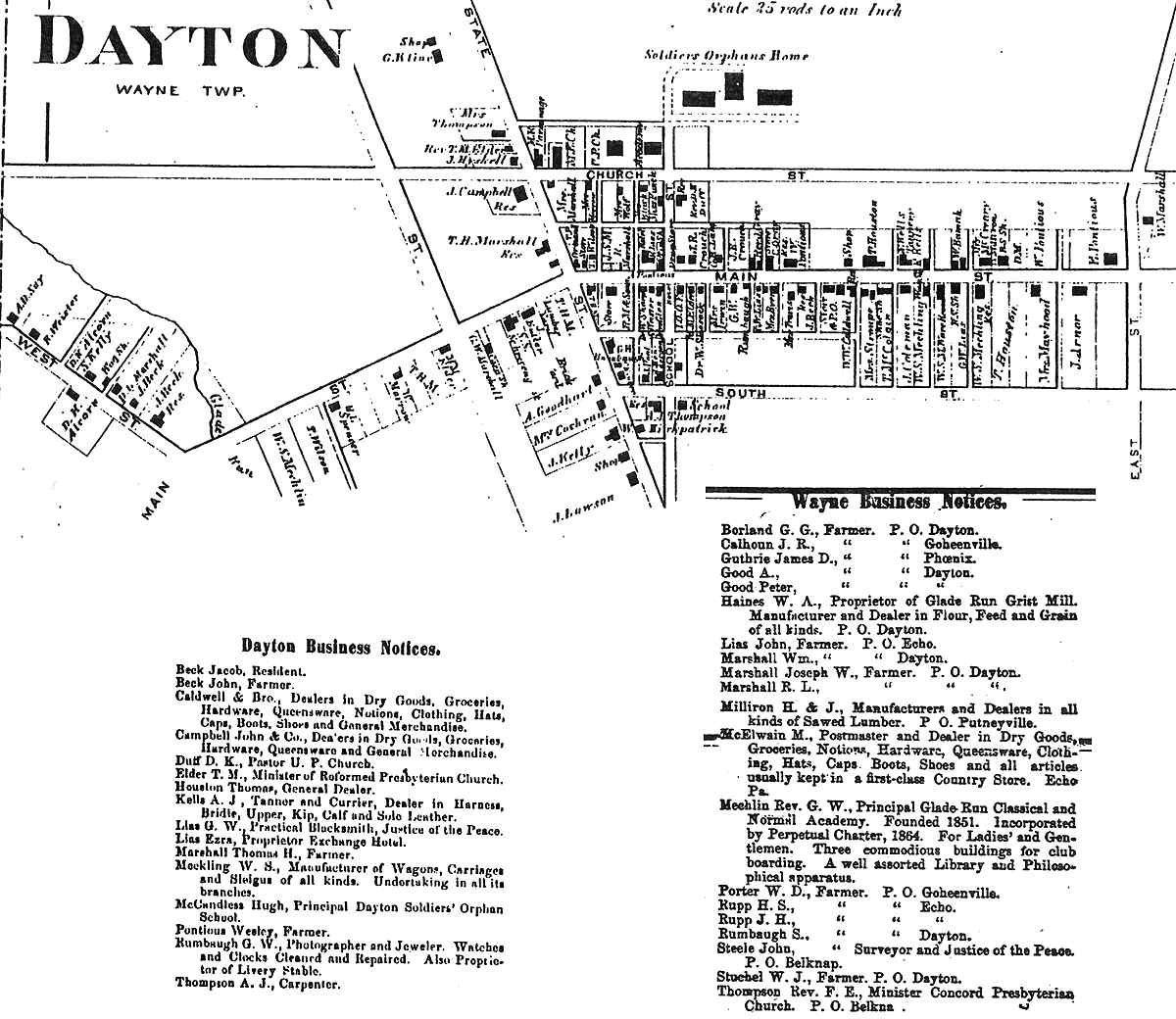
South Bend (66) South Buffalo (69) Sugar Creek (75) Valley (77) Washington (80) Wayne (83) West Franklin (86) |
|
BOROUGH MAPS Note: Some boroughs are combined on a page or appear with the township map. |
|||
|---|---|---|---|
| TOWNS | TOWNSHIP | TOWNS | TOWNSHIP |
|
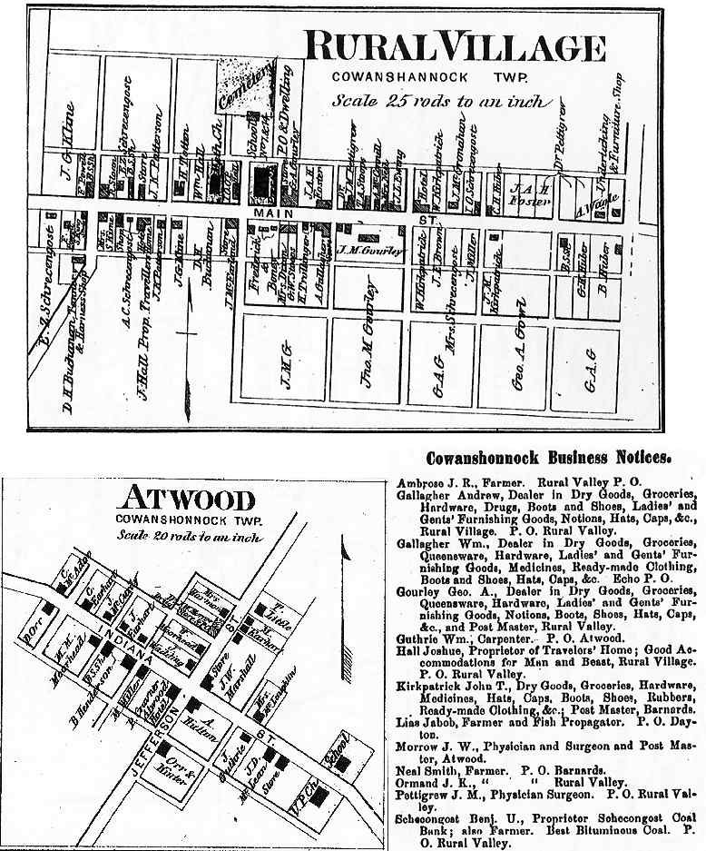
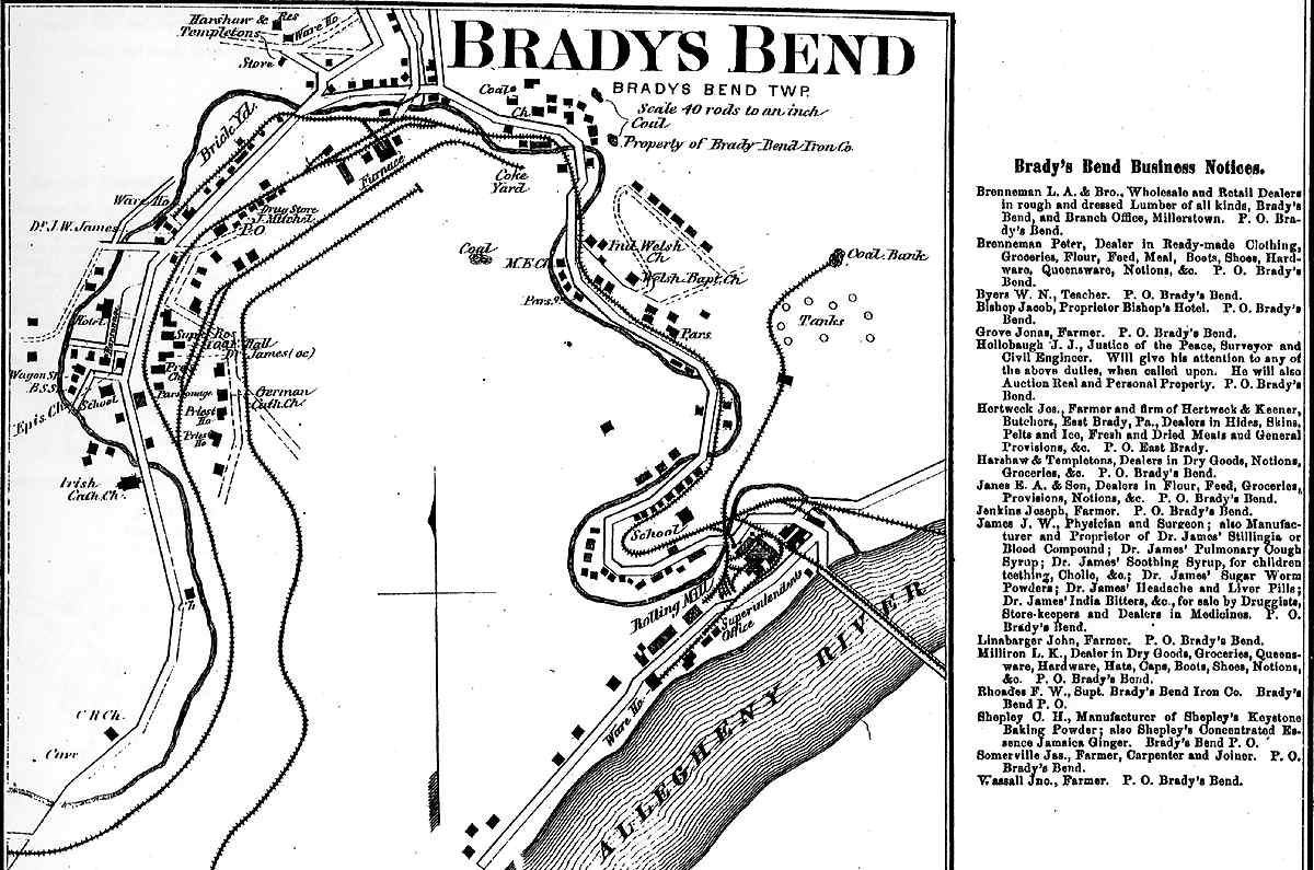
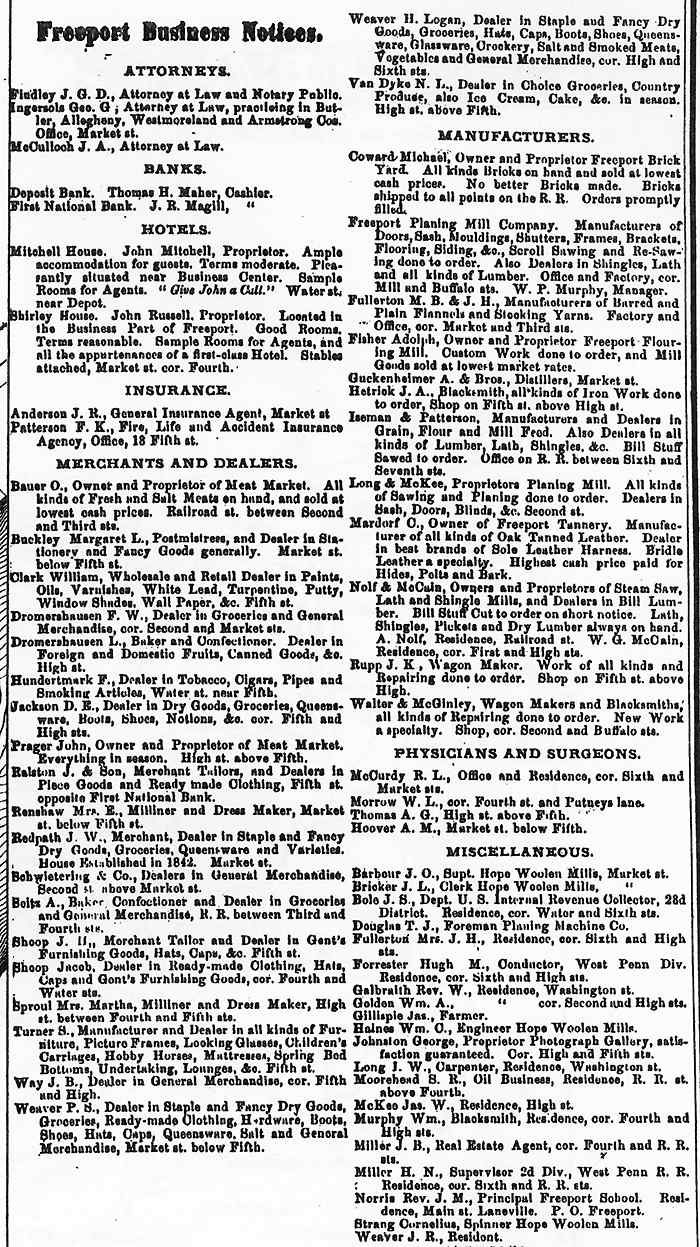
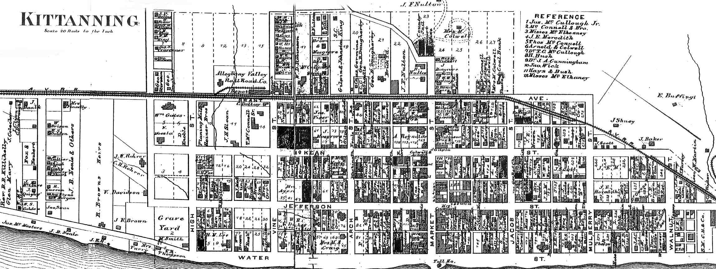
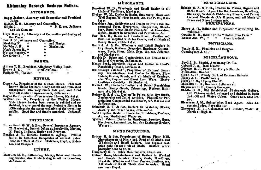
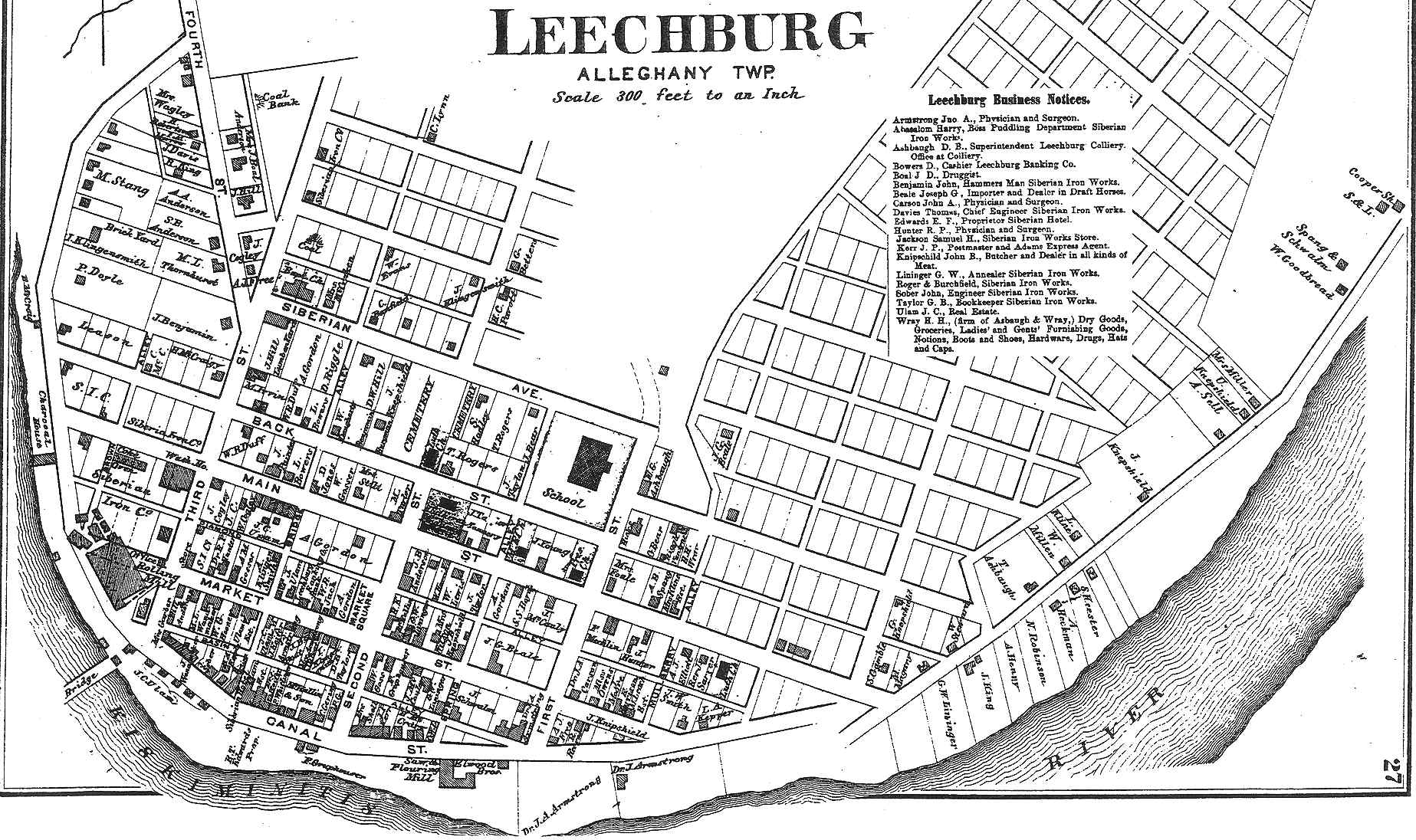
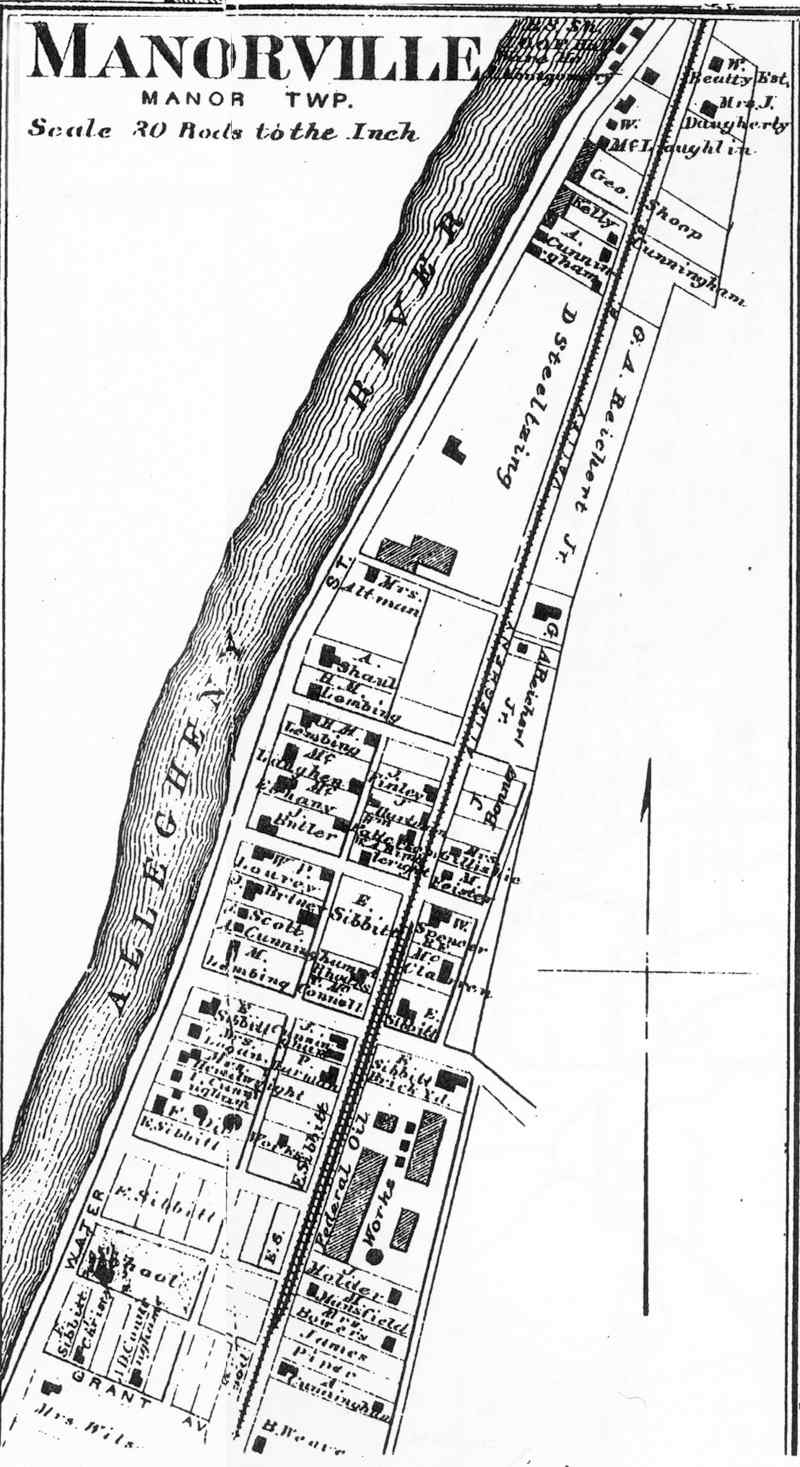
Apollo (45) Atwood (31) Brady's Bend (29) Buffalo (86) Clinton (69) Craigsville (86) Dayton (87) Eddyville (66) Elderton (61) Freedom (67) Freeport (72) Freeport Bus. (73) Happy Retreat (37) Kittanning (80) Kittanning Bus. (81) Leechburg (27) Manorville (52) |
Kiskiminetis Cowanshonnock Brady's Bend West Franklin South Buffalo West Franklin Wayne Red Bank Plum Creek Cowanshonnock South Buffalo Hovey (Borough) Alleghany Manor |
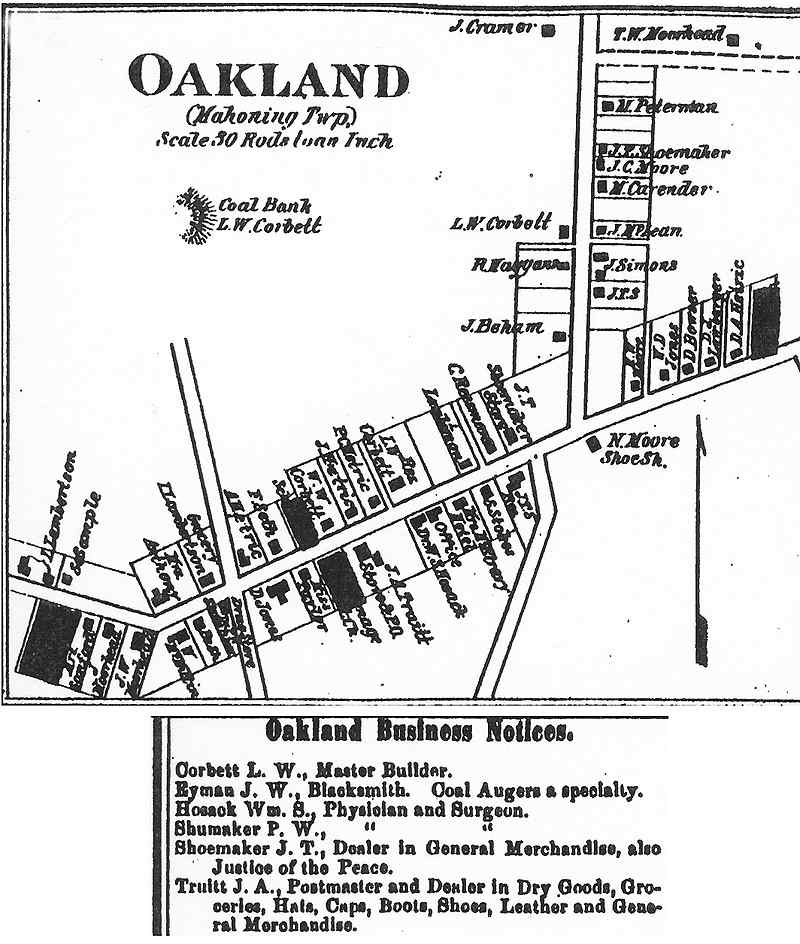
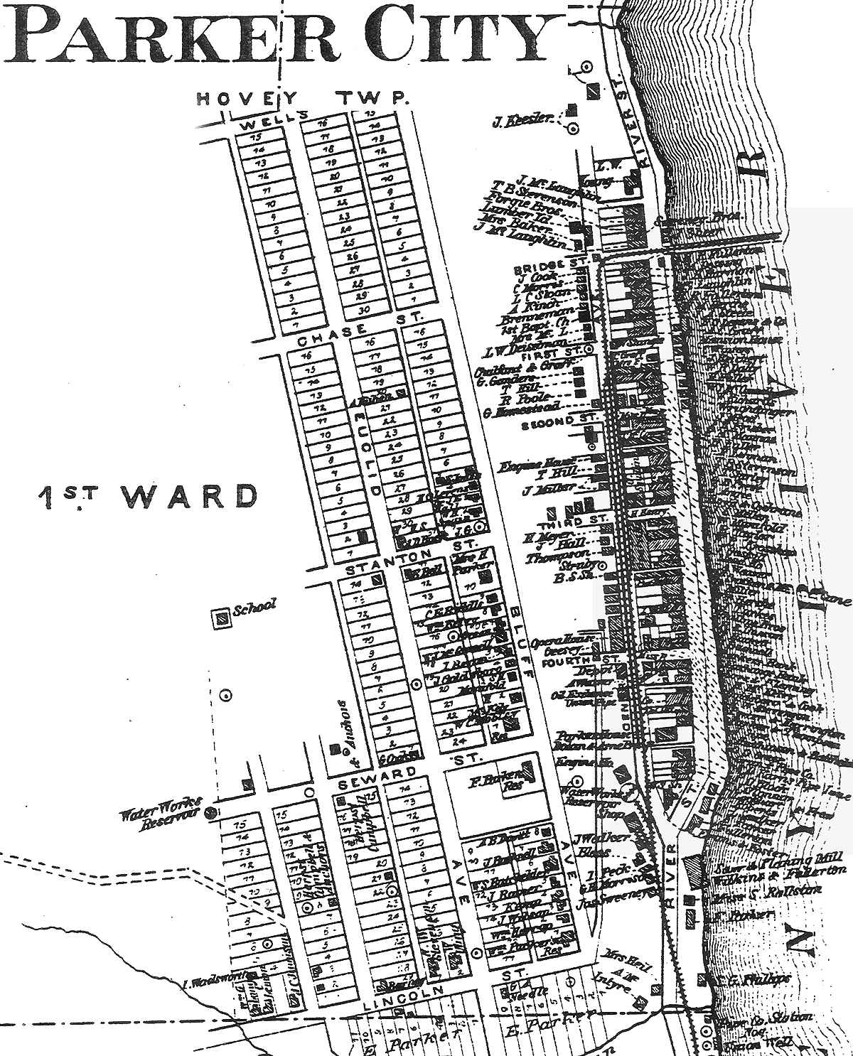
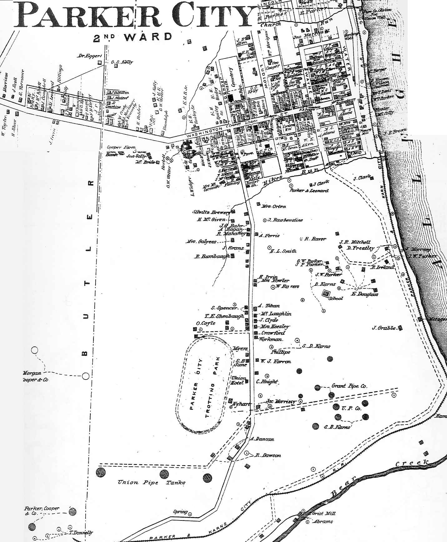
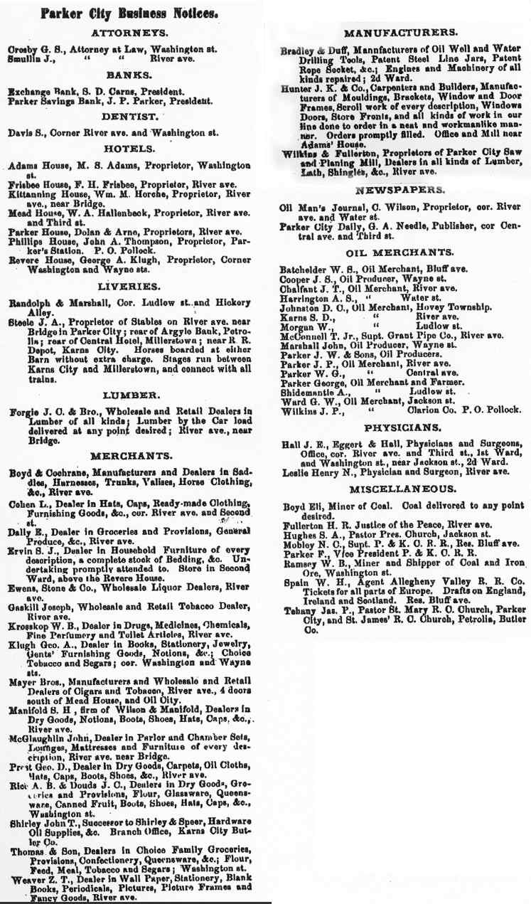
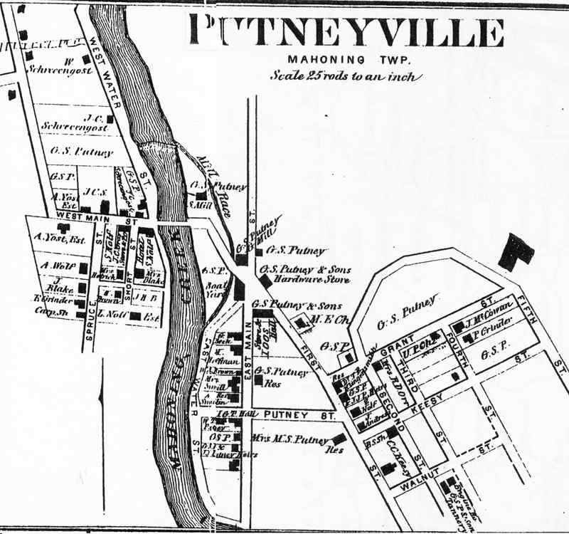
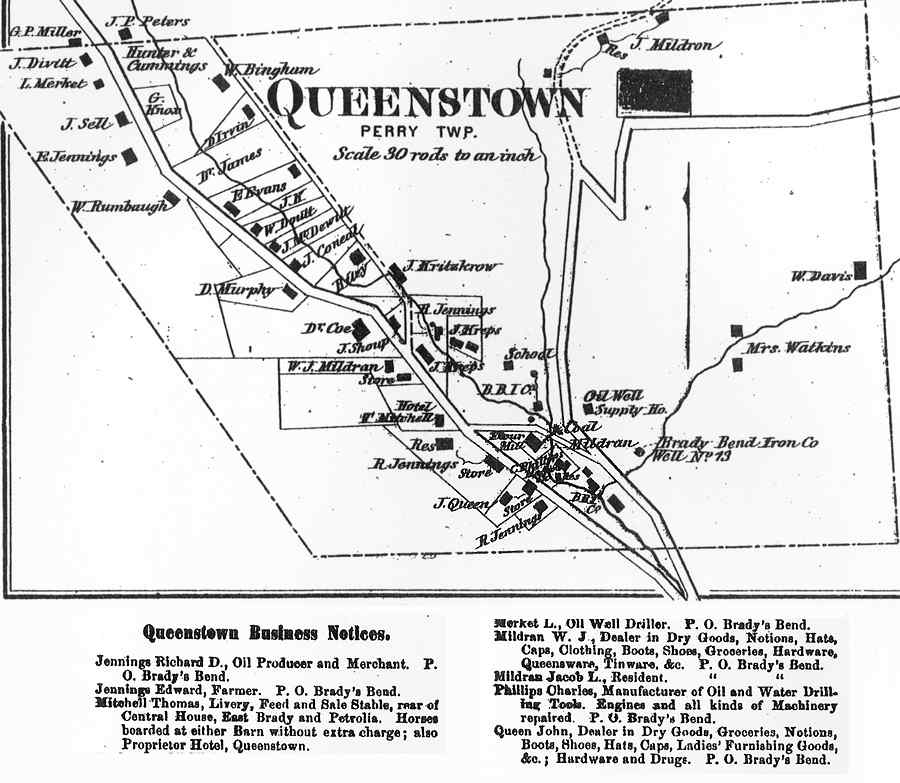
Middlesex (35) Milton (67) Montgomeryville (35) New Salem (67) Oakland (52) Parker City (1) (40) Parker City (2) (41) Parker City Bus. (37) Putneyville (52) Queenstown (57) Rimerton (49) Rosston (53) Rural Village (31) Templeton Station (63) Troy Hill (77) Worthington (87) |
E. Franklin Wayne E. Franklin Red Bank Mahoning Hovey Mahoning Perry Madison Manor Cowanshonnock Pine Valley West Franklin |
Click on map to see larger map.