Bucks County Pennsylvania Township Maps

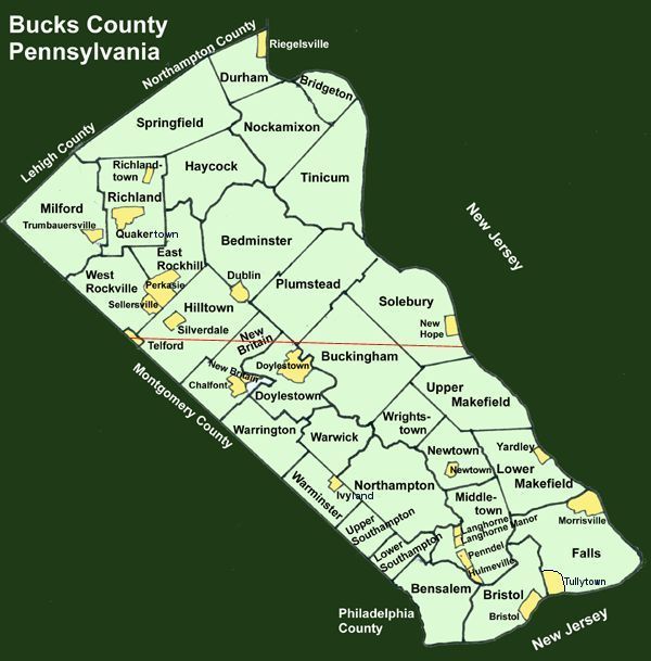
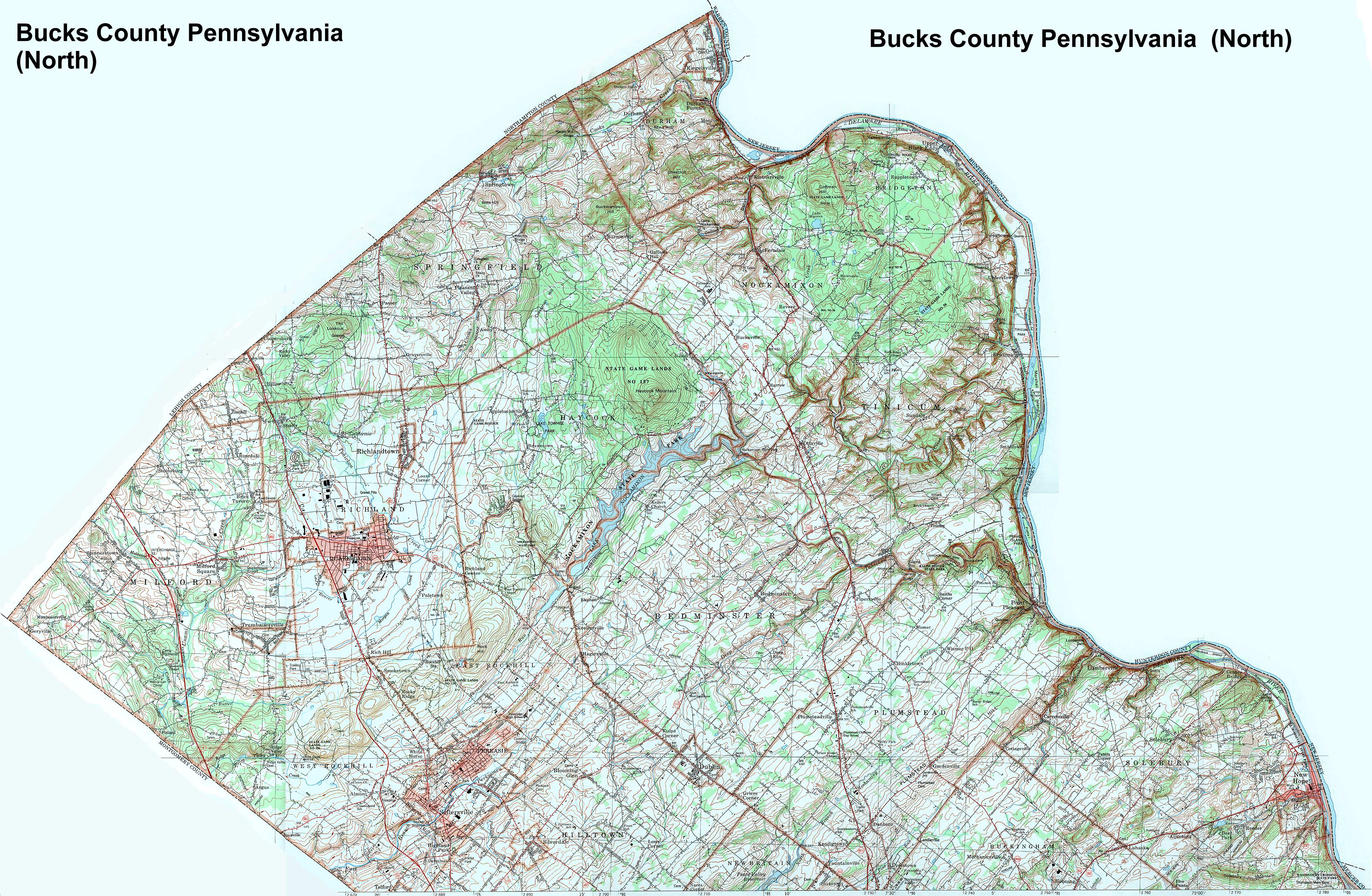
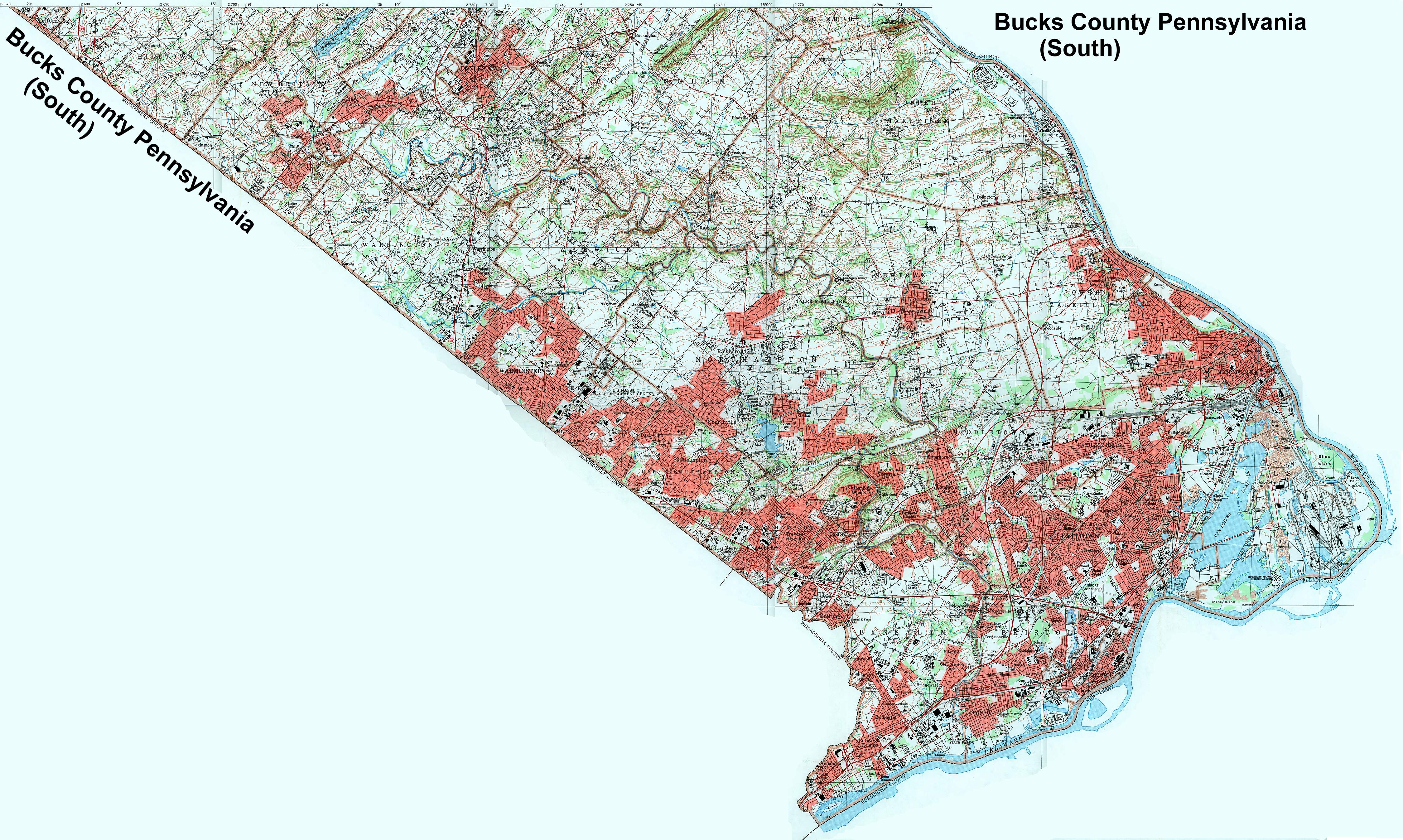
Image Map: This an index map of townships and boroughs in Bucks County Pennsylvania. The source is a 1/50,000 USGS Geological Survey Map of Bucks County dated 1983; based on 1/24,000 maps dated 1953 (73PR) through 1966 (73PR).

To see the northern part of the county map click here. To see the southern part of the county map click here. Adjacent counties shown on the image map have active links to their USGS maps. A text list of the townships, boroughs and villages is shown below.

Bucks County Townships

Bucks County North Bucks County South Northampton County Lehigh County Montgomery County Philadelphia County New Jersey New Jersey

The list below shows boroughs and villages within each township; however, some townships may be combined in one map. To search for cemeteries, villages and other features visit the USGS GNIS site. Check here for information on how to order US Geological Survey Maps of Pennsylvania counties.


County Genealogy Sites: There are links to Pennsylvania county USGenWeb sites at the bottom of the Pennsylvania Map Index pages.

Pennsylvania Map Index

USGS Map Index


Valid HTML 4.01!